The official Metro map from Villedor City Transportation
Jump to navigation
Jump to search
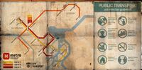

The official Metro map from Villedor City Transportation is one of mementos found Dying Light 2. It is part of the Artifact Collectable set.
Text
This remnant of the Old World shows the routes of the three metro lines that served the city before the fall of civilization. Villedor's subway system was built in the second half of the 20th Century, in the period of economic boom that also resulted in the reconstruction of the Central Loop after World War II.